By Anthony Awat and Perry Saico
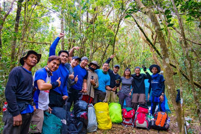
After more than a year since an exploration team visited Mt. Kemalugong in January 17, 2016, NEBMCI carries out a Trail Recovery and Reassessment Program in partnership with the Local Government Unit (LGU) of Brgy. Siclong, Laur, Nueva Ecija. With Mt. Kemalugong possibly opening to public anytime soon, the Trail Recovery Program is an important part of the preparation that will ensure a safe and fun adventure for all tourists coming to see the mountain and the spectacular scenery around it. The first wave of the program was conducted last February 18-19, 2017 while the second wave was March 25-26, 2017. NEBMCI plans to continue this effort until the trail becomes safe and well established.

A. Mt. Kemalugong Background
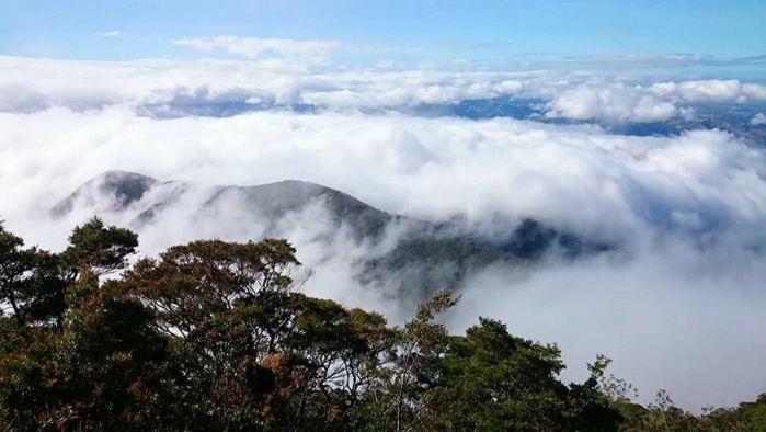
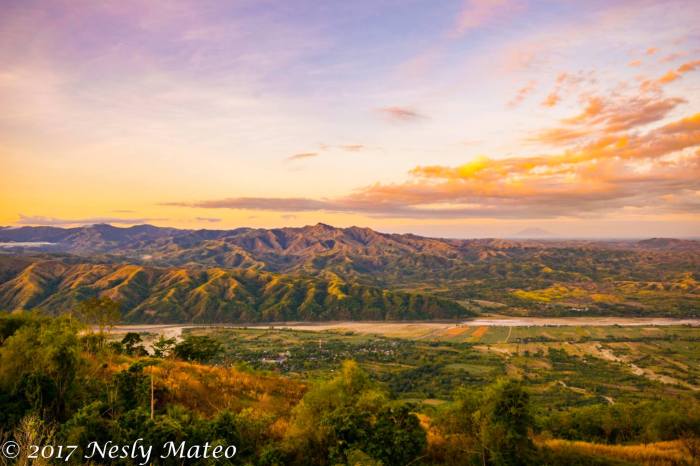
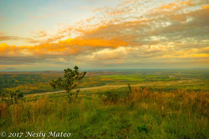
Nueva Ecija is home to many of the most beautiful hiking destinations in the region. Among the most popular include Mt. 387 Batong Amat in Caranglan, Mt. Sawi in Gabaldon, Mt. Mapait in Palayan, Mt. Labi in Bongabon and Mt. Kemalugong in Laur. Mt. Kemalugong is considered the highest peak of Nueva Ecija at an estimated elevation of 1750 meters above sea level. The name “Kemalugong” is an Ilocano term from the rootword “Kallugong” meaning hat. The clouds surrounding the top part of the mountain gives people the impression that it is wearing a hat. Mt. kemalugong is located at the boundary of Aurora and Nueva Ecija provinces and is part a of the Sierra Madre mountain range. From its summit, the provinces of Pampangga, Nueva Vizcaya, Rizal, Quezon Province, Pangasinan, Tarlac and some parts of Cordillera can be seen as well.
The summit of Mt. Kemalugong was given the name “Paasa Peak”. The reason behind was that during the first exploration, it happened several times that the team expected to have reached the summit, only to find out that they still did not, hence the name “Paasa Peak”- a reminder of how the exploration team struggled to reach the true summit of Mt. Kemalugong. The trail- “Tobal Trail” was named after the local guide Mr. Christobal Linda.
Learn more about Mt. Kemalugong (5/9) – Laur, Nueva Ecija
B. Features
Mt. Kemalugong is not yet open to public. The Local Gorvernment Unit (LGU) of Laur Nueva Ecija partnered with NEBMCI in its exploration and development. Organizations who want to visit requires a referral from NEBMCI to be given permission.
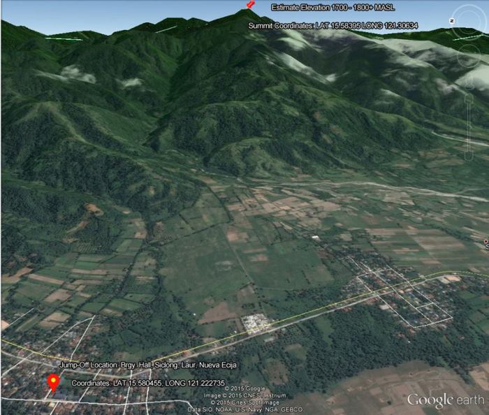
Entry Point/Jump off Location: Brgy Hall Siclong, Laur Nueva Ecija
Summit Coordinates: LAT 15.58395 LONG 121.30634
Coordinates: LAT 15.580455 LONG 121.222735
Estimated Elevation: 1750+ MASL
Days required/ Hours to summit: 1-2 days/ 20-24 hours
Specs: Major climb, Difficulty 5/9, trail class 1-4
Phone signal: +
Limatik: NA
Rattan: ++
Lipa (Poison Ivy): +++
C. Difficulty
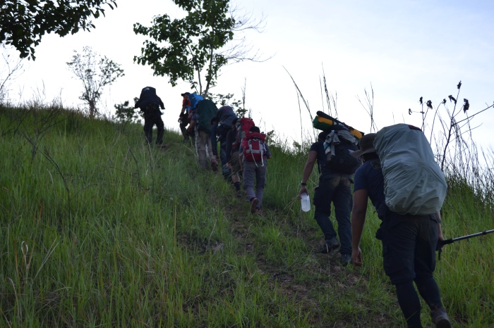
With a 5/9 difficulty rating featuring an exhausting 10 to 12 hours of unlimited assault and 5 to 6 hours of knee-shaking descent, Mt. Kemalugong is not advisable for beginners. Climbing this mountain requires training and a great deal of patience and stamina.
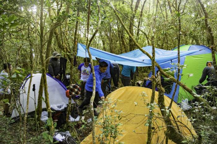
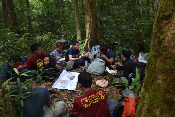
The trek to Mt. Kemalugong begins at the foot of the Gordon Hill. Don’t be misled by the name “Gordon Hill”, it is not the usual welcome trail you think. After 15 minutes from jump off, the trail going upward the Gordon Hill begins with a series of 50 to 70 degrees assault that continues for almost 3 hours. Following the Gordon Hill is the entrance to the forest area which features the same and even much more difficulty. For another 8 to 9 hours, be prepared for a continuous and patience-draining successive assaults that will really test you to your limits. Expect 30 to 60 minutes of continuous climb on a more than 50 degrees inclined trail with 5 to 15 minutes of downward or flat trails in between. There are 3 campsites where trekkers can have a rest, meal and a power nap. The key to surviving Mt. Kemalugong is practicing the so called “Lakad Everest” or slow-paced walk. It is not a matter of how fast you walk but how far you can go. Energy conservation is important.
Another major contributing factor to the difficulty of Mt. Kemalugong is the lack of water source. A water source can be found at the middle of Gordon Hill which is 10 hours from the summit. For a group of 10, each team member must be able to bring a minimum of 4 liters of water which will be used for hydrating and cooking. To lessen the amount of water carried by each person, the team can leave liters of water at some parts of the trail which can be used during descent the following day.
Along the trail, there are several areas with Poison Ivy or Lipa. This is why climbers are advised to wear long sleeves, trekking pants and trekking shoes for safety purposes.
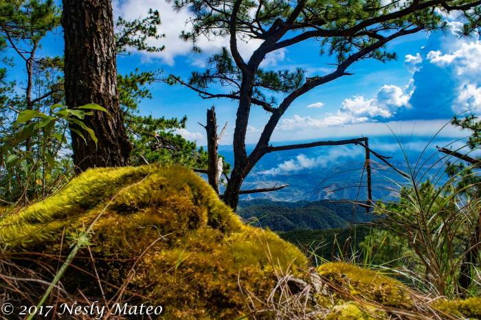
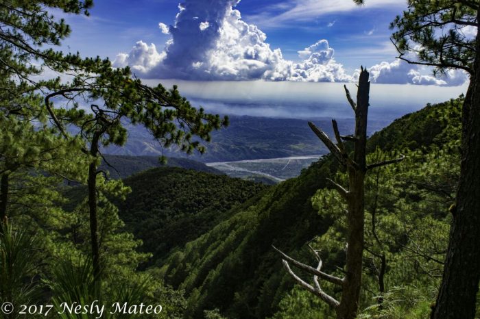
D. Kemalugong Trail Recovery Photo Gallery ( by Anthony Awat and Nesly Mateo)
Gordon Hill

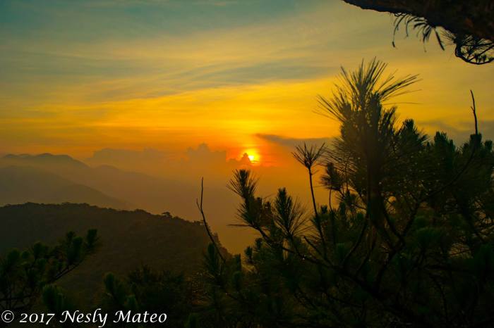
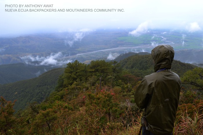
Summit (Paasa Peak- 1750+ MASL)
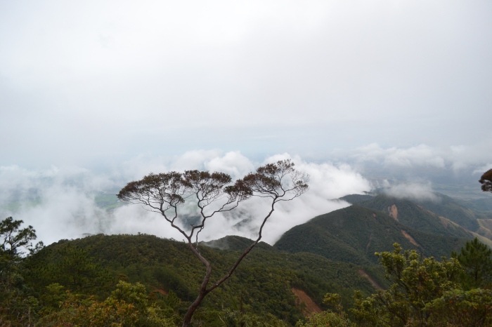

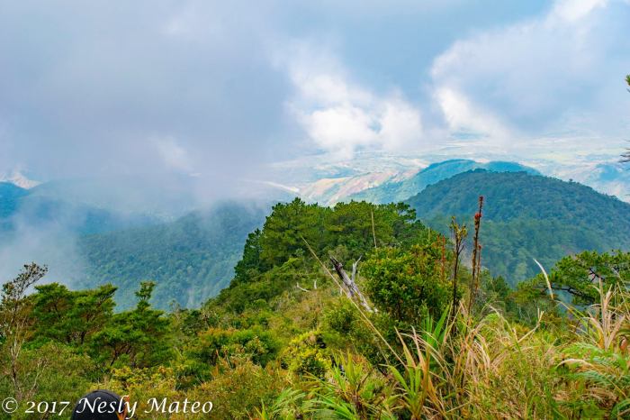
View deck (Bonzai Area)
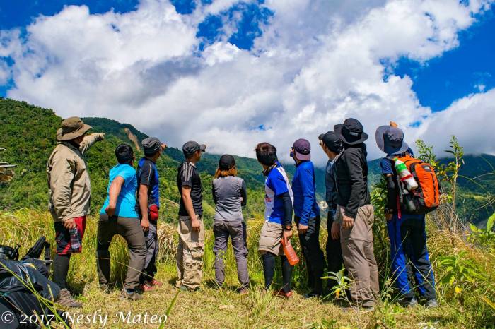
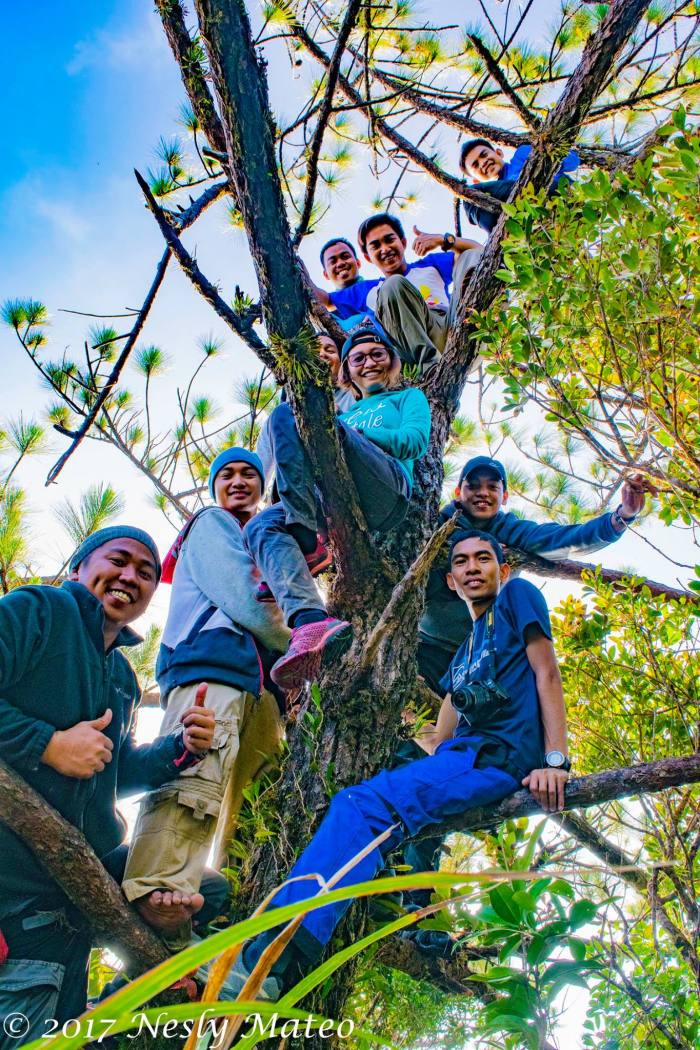
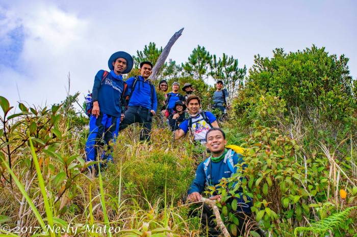 Group photo at viewdeck


Smallest Rafflesia Specie
This rare Rafflesia specie (corpse flower) – Rafflesia consueloae is exclusively found in the Philippines. It is also known as the “dwarf among the giants”.
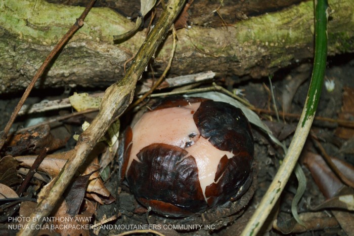

Know more about the world’s smallest Rafflessia:
World’s smallest Rafflesia flower discovered in Nueva Ecija
Grass and pine ridge


E. Itinerary
Day 01
2230 At Cubao, Take a bus ride bound to Cabanatuan City
0130 ETA Cabanatuan City Terminal,
0200 ETD going to Brgy. Siclong (Private Vehicle)
0330 ETA Jumpoff Point Brgy. Siclong, Registration @Brgy. HallEntry Point side of Brgy. Cemetery
0400 Start trek (Farmland)
0415 River Crossing
0510 ETA Gordon River(water source)
0530 ETA Kubo sa Kawayanan
0600 Start Trek up to Gordon Hill/Cogon Area
0645 Arrival at Forested Area
0715 ETA Giant Baliti Tree
0720 Start trek up (series of uphill and downhill)
0930 ETA @ Creepy Kubo
1130 Possible Lunch stop at the trail
1230 Start Trek Up
1330 ETA Tobal’s Trail/ Hunter’s Trail
1600 Arrival @Campsite Set up tent (optional)
Day 02
0500 Wake up Call/Breakfast
0600 Start trek to Paasa Peak via Paasa Ridge
0725 ETA @ Paasa Peak Campsite
0735 ETA @ Mt. Kemalugong Summit (Paasa Peak)
0830 Start Descent
0945 Campsite (Break Camp)
1100 Start Descent via Tobal’s Trail
1445 ETA at Giant Baliti Tree
1500 Arrival Gordon Hill/Cogon Area
1630 ETA Gordon River
1745 River Crossing
1800 Farmlands
1830 Arrival at Brgy. Hall (Tidy Up)
1850 Head Back to Cabanatuan City (via rented service)
Related Topics:
Related topics:
Join the Adventure: Be a part of the Nueva Ecija Backpackers and Mountaineers Community (NEBMC)!!!
Mt. Mapait: The latest hiking destination in Palayan City Nueva Ecija!
Dayhike at Mt. 387 Batong Amat Caranglan Nueva Ecija
#2017TravelBucketlist: Things to Consider While Planning Your Next Trip by TRAVELPROS
